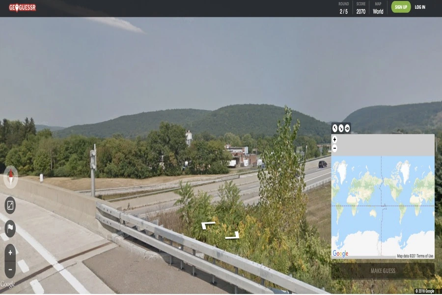
Ever shared a photo online, thinking you have kept all your personal info under wraps? Well, think again. Imagine an AI that can play detective with just a Google Street View image. Sounds like something out of a sci-fi movie, right? Not anymore. Meet PIGEON – Predicting Image Geolocations, the brainchild of Stanford University’s savvy graduate students.
These folks have taken the AI game to a whole new level. So, forget about blurring license plates and hiding street names – PIGEON sees through it all. In this blog, we will explore the nuances of PIGEON and delve into the exciting emergence of Predicting Image Geolocations.
Decoding The PIGEON Algorithm
The journey of PIGEON began within the confines of a Stanford classroom — Computer Science 330, Deep Multi-task and Meta Learning. Inspired by their shared passion for the online game GeoGuessr, Lukas Haas, Michal Skreta, and Silas Alberti embarked on a mission to develop an AI player capable of outperforming humans in geolocation challenges.
The PIGEON algorithm plays a pivotal role in enhancing visual search and image recognition capabilities. Outlined in a preprint document titled “PIGEON: Predicting Image Geolocations,” the collaborative efforts of Lukas Haas, Michal Skreta, and Silas Alberti materialized into the development of PIGEON.
This image recognition model is an offshoot of their proprietary pre-trained CLIP model, namely StreetCLIP. To delve into the technicalities, the model is intricately enhanced through the integration of semantic geocells—distinct areas of land reminiscent of counties or provinces. These geocells meticulously factor in region-specific intricacies like road markings, infrastructure quality, and street signs. Complementing this, the model incorporates ProtoNets, a classification technique that proficiently operates with minimal examples.
Applications of Image Geolocation
The potential applications of image geolocation are as diverse as the images themselves. Here are some of the most prominent and promising areas where this technology can make a significant impact:
1. Urban Planning and Infrastructure Development
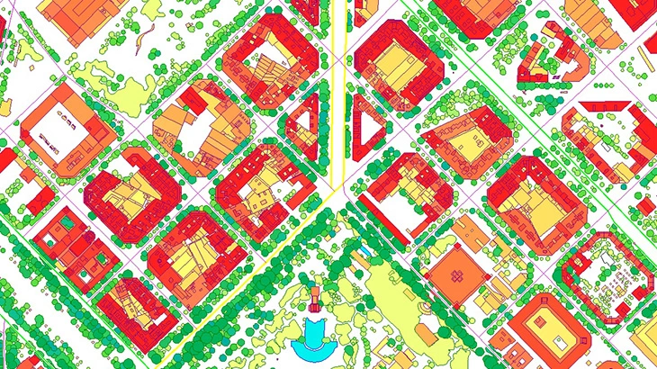
Predicting Image Geolocations (PIGEON) can play a pivotal role in urban planning by utilizing geographic information systems (GIS) data for precise mapping and analysis. This technology aids city planners in understanding the geographical layout, identifying potential areas for development, and optimizing infrastructure projects.
The City of Barcelona, Spain, utilizes PIGEON and GIS for optimized urban planning decisions, enhancing traffic management and public space utilization.
2. Environmental Monitoring and Conservation
Using geospatial information systems, PIGEON can contribute to environmental monitoring. By analyzing images and recognizing geographic features, it becomes a valuable tool for biodiversity assessment, habitat monitoring, and conservation efforts. GIS technology enhances the accuracy of spatial data in these critical initiatives.
WWF employs PIGEON and GIS to monitor endangered species, aiding in more effective global conservation efforts.
3. Disaster Response and Management
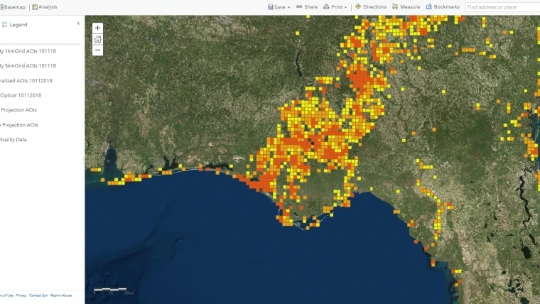
In times of natural disasters, the rapid analysis of affected areas is crucial. PIGEON, with its image recognition capabilities and integration with geospatial information systems, aids in quick assessment and mapping of disaster-stricken regions. This accelerates response efforts and helps in resource allocation for effective disaster management.
FEMA (Federal Emergency Management Agency) in the United States utilizes Predicting Image Geolocations to assess the impact of natural disasters. By combining image recognition and geospatial information systems, FEMA can quickly identify affected areas, prioritize response efforts, and allocate resources efficiently.
4. Tourism and Travel Planning
For travelers seeking unique experiences, PIGEON’s ability to predict image geolocations can be a game-changer. By utilizing geographical mapping and GIS technology, it offers users a visual search tool to explore destinations based on their preferences. Users can discover places with similar visual appeal, enhancing their travel planning experience.
Airbnb incorporates PIGEON’s geolocation predictions to enhance its travel planning platform. The platform suggests destinations to users based on their preferences, using geographical mapping and visual search capabilities. This assists travelers in discovering new and visually appealing locations.
5. Archaeological Surveys and Cultural Heritage
PIGEON’s geolocation capabilities find applications in archaeology for site identification and mapping. By integrating with geographical mapping and GIS technology, it aids researchers in conducting surveys, preserving cultural heritage, and documenting archaeological sites for historical conservation.
The National Geographic Society employs PIGEON for archaeological surveys. By utilizing geolocation predictions and GIS technology, researchers can identify potential archaeological sites, map historical structures, and preserve cultural heritage more effectively.
Ethical Implications of Predicting Image Geolocations
The integration of geospatial information systems (GIS technology) with advanced image recognition and visual search capabilities, as exemplified by the Predicting Image Geolocations, or PIGEON, raises pressing ethical and regulatory considerations. Let us explore some of them in this section.
1. Privacy Concerns
The precision of Predicting Image Geolocations (PIGEON) in geolocation predictions gives rise to significant privacy concerns. Individuals may face challenges controlling the dissemination of their location data, potentially leading to unintended exposure of personal information.
2. Security Risks
PIGEON’s application in geolocation poses security risks, especially if the technology is misused for tracking or surveillance. The potential for governments or malicious entities to compromise individuals’ safety and freedom is a notable concern.
3. Ethical Dilemmas
PIGEON introduces ethical dilemmas regarding the responsible use of geolocation data. The technology’s potential for government surveillance, corporate tracking, or stalking necessitates a careful balance between innovation and the protection of individual rights.
4. Regulatory Challenges
The emergence of PIGEON and similar technologies raises regulatory challenges. Governments and regulatory bodies must adapt swiftly to create frameworks that address the ethical, privacy, and security implications of geolocation predictions, ensuring responsible and transparent use.
5. Technological Dependence
Increasing reliance on PIGEON for geolocation data may lead to technological dependence. Organizations and individuals must be cautious not to solely rely on AI-driven predictions, recognizing the importance of human oversight and accountability in decision-making processes.
Conclusion: Balancing the Power of PIGEON
The PIGEON algorithm, born out of a student project, not only triumphs in geolocation challenges but also raises critical questions about the responsible use of AI. As we navigate the uncharted territories of artificial intelligence, a delicate balance must be struck between technological advancement and safeguarding privacy.
The geolocation journey undertaken by PIGEON is both fascinating and cautionary, serving as a beacon for the ethical integration of AI in our hyper-connected world.
The Tech Junction is the ultimate hub for all things technology. Whether you’re a tech enthusiast or simply curious about the ever-evolving world of technology, this is your go-to portal.

